

La Nina Watch Issued, Fall and Winter Weather Shifts
Aug 20, 2025, 9:10 AM CST
Share
MADISON, Wis. (CIVIC MEDIA) – Forecasters are keeping an eye on what seasons ahead may look like in the state, as increased activity prompts a watch.
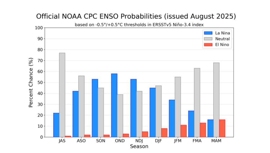
The Climate Prediction Center has issued a La Niña Watch. Which means that by the fall, La Niña conditions start to become more likely.
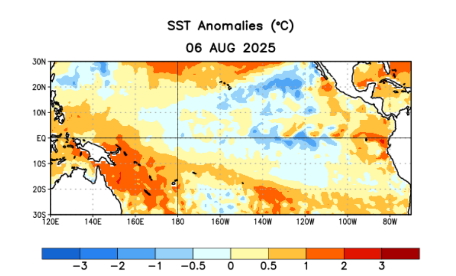
Right now we are in an ENSO-neutral phase, which will stick around through late summer. However, the sub-ocean has already cooled in the region of interest. These negative anomalies are not too strong, but still a step in the direction for the development of a La Niña pattern.
While conditions are favorable, there is still a four in 10 chance that it will not happen. But if it does, it could result in ramped up hurricane activity this autumn in the Atlantic Ocean.
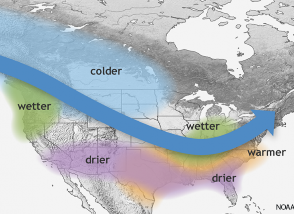
During La Niña winters, the strongest signal usually happens in February and March. For Wisconsin and Minnesota, that means it’s wetter and colder-than-normal conditions are likely, leading to more Alberta Clipper systems and more snow. Heading into early spring, there can also be higher chances for severe weather outbreaks.

Brittney Merlot is Civic Media’s Meteorologist. Email her at brittney.merlot@civicmedia.us.
Want More Local News?
Civic Media
Civic Media Inc.
The Civic Media App
Put us in your pocket.